Monday, 30 September 2013

Cadover Bridge

It has been a long time since we visited Cadover Bridge but recently this part of Dartmoor has been mentioned to me a number of times so I thought it would be good to go there again.  We drove through Plympton to Wotter where we had been told there was an excellent view of Plymouth.  However, it was a misty day and we did not see very much.  Driving on through the clay works was not a very attractive route but we were soon onto the moor which was much more pleasant.

We parked at the National Trust car park at Cadover Bridge.  In the past we have walked from there to Shaugh Bridge, but today we decided to walk up the river.  The first thing I noticed was the sheep grazing by the river.  Most rivers on Dartmoor are fast flowing over boulders, but the river Plym at Cadover flows more gently and I was reminded of Psalm 23 "The Lord is my Shepherd, I shall not want.  He makes me lie down in green pastures, he leads me beside quiet waters"


We crossed over the road by the bridge and started to walk up a small road parallel to the river.  We only walked as far as Trowlesworthy Warren House as the sky was threatening rain.  But as it held off once we were back at our car we did a short walk through the woods in the opposite direction.


It was surprising how quickly the river went from flowing gently to rushing down past boulders.  It seemed like a completely different river.


Although there were some brown, dead leaves on the ground most of the trees were still green.  There were lots of acorns around and some other berries on trees, but no magnificent autumn colour displays yet.

We did not return to Plymouth the way we had come but continued on the same road until we came to Yelverton,  Driving this way over Dartmoor was much prettier than the other way.

Tuesday, 3 September 2013

Heather on Haytor

I wanted to see the heather and gorse on Dartmoor.  According to a Dartmoor National Park leaflet there was a lot around Haytor so I looked for a walk in this vicinity.  Again the Park Authority obliged.  They have an audio walk that you can download from their website.  I printed out the instructions and map and we started walking from the Information Centre at the foot of Haytor.  It was very useful to have such clear instructions and interesting to be given background information on what we passed and saw.

To begin with the heather and gorse was a little disappointing, but as we walked further there was a better display.


As well as admiring the flora there were stunning views to various tors in Dartmoor.  It was very interesting walking around the pond in the Haytor Quarry, and it seemed so unusual to see water lilies growing there. We walked as far as Smallacombe Rocks, but then turned back as we did  not have time to do all the 6 miles of the audio walk.

Most of the way the path was good although we had to pick our way carefully through granite stones as we walked around the base of Haytor.  The view between the two main rocks  was spectacular - you could see all the way to the South Devon coast.

This was a very pleasant walk and I would like to do the second part of it another time.

Sunday, 1 September 2013

Par to Fowey

We caught the train from Plymouth to Par - a pleasant journey as the train (the 9.24 to Penzance) was very quiet, having started in Plymouth.  From Par station we walked down to Par Beach a distance of about .75 miles.  We walked along the back of the beach on the dunes to the far end.  Par is a lovely large sandy beach, it is a pity about the industrial site at the side of it.


As we walked through the car park we missed any southwest coast path sign and so walked to the road and a long way around until we came to the southwest coast path from the Saints Way.  Once we were on the path it was easy to follow it to Fowey.  As usual the path went up and down, but the views were spectacular all the way.

A view back to Par Beach
 After a while we came to Polkerris and we thought this was a lovely beach and harbour.  The sand was fine and there was lots to watch as people were canoeing and windsurfing .  There was also a lovely art gallery there to browse around.

Polkerris
The next stop on our journey was  Gribben Head.  It seemed to be a long time before we saw the tower on the top of this headland and there was lots a climbing so we were glad to be able to rest when we got there.  Up to this point we had been having views of St Austell Bay, but once we were over the top we could see the River Fowey estuary and coast down towards Polperro.

View from Gribben Head


Looking back to Gribbin Head
The walk continued undulating, with some steeper parts, but it helped to see the finishing line.  On the outskirts of Fowey the path signage was confusing as there appeared to be 2 different ways you could take and still stay on the coast path!   Initially we stayed on the top path and started to walk through woods, but that took us away from the coast and so we turned around and headed down to Readymoney Cove.  This was another pretty beach and the walk into Fowey from here was lovely with views of the river and boats between houses.  

A view from Fowey

View across to Polruan
 Once in Fowey we spent an hour wandering among the shops and admiring the views before heading up the hill to catch the bus back to Par Station.  This had been one of the prettiest sections of the coast path we have done and well worth the effort expended.

Saturday, 31 August 2013

Saltram in August

Since our last visit there had been a number of additions to the garden surrounding  Saltram House.  There were some new display boards giving information about features in the garden as well as boards telling visitors about some of the plants.  Scattered around the garden were also some brightly coloured deck chairs.


Saltram is not very colourful in summer, but there were some beautiful flowers out.

Cyclamen on the Lime Avenue

The information board told me this shrub with holly leaves
 is actually Desfontainia Spinosa

Waterlily in the pond

Wednesday, 28 August 2013

The Barbican to Mount Batten

On a couple of occasions we have walked on the South West Coast Path from Turnchapel to Mount Batten and we frequently walk around Plymouth Hoe to the Barbican.  However, we have never walked from the Barbican to Turnchapel.  As our car was being serviced at a garage on Billacombe Road, we thought we would remedy this today.

We started walking from the end of the Laira Bridge towards Mount Batten.  To begin with it was not the most pleasant walk, but we soon came to Oreston and there was a lovely view of yachts on the River Plym.


Mount Batten as  really close across the water, but we had to walk 2 miles  round the edge of the river.


We continued walking around Hooe Lake and across the causeway at the bottom of Radford Park.  the castle astride the path looked out of place.


We continued walking up through woodland and then down the other side till we came to Turnchapel.   It was a good path all the way and well marked.  Although we had walked from Turnchapel to Mount Batten before we continued our walk to Mount Batten before catching the bus back to the Laira Bridge.

From Laira Bridge we started walking towards the Barbican.  As with the first part of this mornings walk this section of the South West Coast Path is not very pleasant as you walk past industrial units, with just glimpses of the river Plym between them.  However, after a while we were opposite Mount Batten and it was interesting to see this from the other side of the river.


St Christopher on wall at side of South West Coast Path
Before long we were walking into the Barbican.  This was not one of the most picturesque parts of the South West Coast Pat, but there was still some beautiful scenery and I was glad I had done it.

Monday, 26 August 2013

Ivybridge - Puffing Billy walk

We had found it difficult to follow the route of our last walk, and afterwards we were more tired than usual.  We therefore wanted an easy walk today and so were pleased to see there were no steep climbs on this walk and the way was very obvious.

The instructions regarding the starting point on the BBC website were very clear (see http://www.bbc.co.uk/devon/outdoors/walks/puffingbilly.shtml).  The lane off the B3213 was very narrow and I was glad I did not meet anyone coming in the opposite direction.  At the top of the lane I was surprised to see so many cars parked.  There was space for about 8 cars and there were already 6 there.

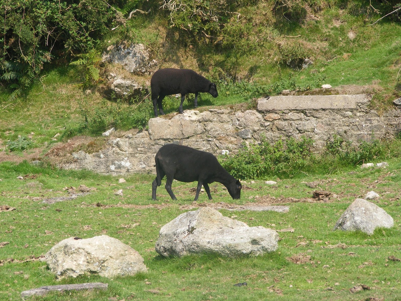
As promised it was easy to find the track of the Redlake Tramway and we were soon walking along.  Unfortunately there was a mist, or heat haze, in the distance and the visibility  was not good.  This was a pity as there were extensive views in all directions, but there was no point in photographing them.  As we walked along there were plenty of livestock, cows, sheep and some horses.  The first flock of sheep we saw were all black, but later we came upon white and speckled ones.


There were quite a few other people walking in this area, some on the same track as us and others on paths that led off it that either went down to Ivybridge or up to nearby tors.  After a while the track became part of the Two Moors Way and some were obviously walking this route.


The track goes on for 7 miles to Redlake, gradually going uphill, but never steeply.  You really felt as if you were in the middle of the Dartmoor wilderness.  We knew we would  not be able to walk all the way to Redlake and back so stopped after walking an hour.  Although it was a linear walk and we had to return the way we came we noticed different things on the way back, such as a row of stones.

This was a very pleasant walk which would have been spectacular if it had been a clear day.

Sunday, 25 August 2013

Bere Alston to Bere Ferrers via Tamar Discovery Trail

Having done the first part of the the Tamar Discovery Trail a couple of days ago we thought we would attempt another section today.  We took the train to Bere Alston, which is always a very pleasant journey.  When we came out of the station it was not clear which way to go as there were footpath signs in 3 directions.  Looking at our map we realised we needed to walk towards the village and headed in that direction.  We knew we had to turn off the road in the village but we did not see the sign and had to turn around and retrace our steps.  The sign was attached to a road name sign.  From our map it looked as if we had to turn off this road after a short while but there was no signs, however as there had been no signs on this trail elsewhere we followed our instinct but yet again we were wrong!  We walked around an residential estate and came out where we started. We asked someone we passed the direction and so were confident as we continued walking down the road.  This was a good track going gradually downhill that led us to Lockridge Farm.

As soon as we passed the farm the path became became small and was overrun with grass (which was wet and slippery) and nettles.  Fortunately the path did improve and we went on for a while until we came to a very steep hill.  This was difficult to walk up as the path consisted of  loose earth.  At the top there was a stile but no sign telling us which way to go.  We started climbing up the field and came to a stile marked a public footpath, but it did not have the apple sign for the Tamar Discovery Trail and we thought we needed to follow the direction of the river so we went along the other side of the field. At least the views from this field were good.


The end of the field as a dead end so we retraced our steps and went to the stile at the top of the field.  As we followed the direction of the footpath sign we came to another stile and this time it had an apple sign on it!  Why wasn't the previous stile marked?  We continined along the path and discovered that approximately every other stile was marked.  This was OK as the the path went straight on until we came to the road at Weir Quay.  This was the best  stretch of walk - a good path (a quiet road) and pleasant views of the river.  Although it was unfortunate the tide was out so there was a lot of mud.


We continued along the road, first uphill and then down, until there was a path off that went along a stream.  Fortunately we saw the steps leading to this as the signpost marking it had fallen over.  We continued along this path until the entrance to Thorn Point.  We attempted to go down to the point but it was too marshy to walk through.  There was no Discovery Trail sign at this  point but followed the map hoping we were going right.  Eventually we found another sign.  We then walked into Bere Ferrers and we glad to stop at the Old Plough for a drink.

We started to walk on to Lopwell, but with all the diversions if we had gone all the way we would have missed the next train and we did not want to wait a further 2 hours, so after a while we turned around and made our way back to the Station and the train back to Plymouth.

Of all the walks we have done, this must be the worse as far as poor marking and the condition of the path in places.  From the map it looked as if there would have been good views of the river for a lot of the way, but this was also disappointing.  We definitely won't be doing this walk again!