Saturday 31 August 2013

Saltram in August

Since our last visit there had been a number of additions to the garden surrounding  Saltram House.  There were some new display boards giving information about features in the garden as well as boards telling visitors about some of the plants.  Scattered around the garden were also some brightly coloured deck chairs.


Saltram is not very colourful in summer, but there were some beautiful flowers out.

Cyclamen on the Lime Avenue

The information board told me this shrub with holly leaves
 is actually Desfontainia Spinosa

Waterlily in the pond

Wednesday 28 August 2013

The Barbican to Mount Batten

On a couple of occasions we have walked on the South West Coast Path from Turnchapel to Mount Batten and we frequently walk around Plymouth Hoe to the Barbican.  However, we have never walked from the Barbican to Turnchapel.  As our car was being serviced at a garage on Billacombe Road, we thought we would remedy this today.

We started walking from the end of the Laira Bridge towards Mount Batten.  To begin with it was not the most pleasant walk, but we soon came to Oreston and there was a lovely view of yachts on the River Plym.


Mount Batten as  really close across the water, but we had to walk 2 miles  round the edge of the river.


We continued walking around Hooe Lake and across the causeway at the bottom of Radford Park.  the castle astride the path looked out of place.


We continued walking up through woodland and then down the other side till we came to Turnchapel.   It was a good path all the way and well marked.  Although we had walked from Turnchapel to Mount Batten before we continued our walk to Mount Batten before catching the bus back to the Laira Bridge.

From Laira Bridge we started walking towards the Barbican.  As with the first part of this mornings walk this section of the South West Coast Path is not very pleasant as you walk past industrial units, with just glimpses of the river Plym between them.  However, after a while we were opposite Mount Batten and it was interesting to see this from the other side of the river.


St Christopher on wall at side of South West Coast Path
Before long we were walking into the Barbican.  This was not one of the most picturesque parts of the South West Coast Pat, but there was still some beautiful scenery and I was glad I had done it.

Monday 26 August 2013

Ivybridge - Puffing Billy walk

We had found it difficult to follow the route of our last walk, and afterwards we were more tired than usual.  We therefore wanted an easy walk today and so were pleased to see there were no steep climbs on this walk and the way was very obvious.

The instructions regarding the starting point on the BBC website were very clear (see http://www.bbc.co.uk/devon/outdoors/walks/puffingbilly.shtml).  The lane off the B3213 was very narrow and I was glad I did not meet anyone coming in the opposite direction.  At the top of the lane I was surprised to see so many cars parked.  There was space for about 8 cars and there were already 6 there.

As promised it was easy to find the track of the Redlake Tramway and we were soon walking along.  Unfortunately there was a mist, or heat haze, in the distance and the visibility  was not good.  This was a pity as there were extensive views in all directions, but there was no point in photographing them.  As we walked along there were plenty of livestock, cows, sheep and some horses.  The first flock of sheep we saw were all black, but later we came upon white and speckled ones.


There were quite a few other people walking in this area, some on the same track as us and others on paths that led off it that either went down to Ivybridge or up to nearby tors.  After a while the track became part of the Two Moors Way and some were obviously walking this route.


The track goes on for 7 miles to Redlake, gradually going uphill, but never steeply.  You really felt as if you were in the middle of the Dartmoor wilderness.  We knew we would  not be able to walk all the way to Redlake and back so stopped after walking an hour.  Although it was a linear walk and we had to return the way we came we noticed different things on the way back, such as a row of stones.

This was a very pleasant walk which would have been spectacular if it had been a clear day.

Sunday 25 August 2013

Bere Alston to Bere Ferrers via Tamar Discovery Trail

Having done the first part of the the Tamar Discovery Trail a couple of days ago we thought we would attempt another section today.  We took the train to Bere Alston, which is always a very pleasant journey.  When we came out of the station it was not clear which way to go as there were footpath signs in 3 directions.  Looking at our map we realised we needed to walk towards the village and headed in that direction.  We knew we had to turn off the road in the village but we did not see the sign and had to turn around and retrace our steps.  The sign was attached to a road name sign.  From our map it looked as if we had to turn off this road after a short while but there was no signs, however as there had been no signs on this trail elsewhere we followed our instinct but yet again we were wrong!  We walked around an residential estate and came out where we started. We asked someone we passed the direction and so were confident as we continued walking down the road.  This was a good track going gradually downhill that led us to Lockridge Farm.

As soon as we passed the farm the path became became small and was overrun with grass (which was wet and slippery) and nettles.  Fortunately the path did improve and we went on for a while until we came to a very steep hill.  This was difficult to walk up as the path consisted of  loose earth.  At the top there was a stile but no sign telling us which way to go.  We started climbing up the field and came to a stile marked a public footpath, but it did not have the apple sign for the Tamar Discovery Trail and we thought we needed to follow the direction of the river so we went along the other side of the field. At least the views from this field were good.


The end of the field as a dead end so we retraced our steps and went to the stile at the top of the field.  As we followed the direction of the footpath sign we came to another stile and this time it had an apple sign on it!  Why wasn't the previous stile marked?  We continined along the path and discovered that approximately every other stile was marked.  This was OK as the the path went straight on until we came to the road at Weir Quay.  This was the best  stretch of walk - a good path (a quiet road) and pleasant views of the river.  Although it was unfortunate the tide was out so there was a lot of mud.


We continued along the road, first uphill and then down, until there was a path off that went along a stream.  Fortunately we saw the steps leading to this as the signpost marking it had fallen over.  We continued along this path until the entrance to Thorn Point.  We attempted to go down to the point but it was too marshy to walk through.  There was no Discovery Trail sign at this  point but followed the map hoping we were going right.  Eventually we found another sign.  We then walked into Bere Ferrers and we glad to stop at the Old Plough for a drink.

We started to walk on to Lopwell, but with all the diversions if we had gone all the way we would have missed the next train and we did not want to wait a further 2 hours, so after a while we turned around and made our way back to the Station and the train back to Plymouth.

Of all the walks we have done, this must be the worse as far as poor marking and the condition of the path in places.  From the map it looked as if there would have been good views of the river for a lot of the way, but this was also disappointing.  We definitely won't be doing this walk again!

Friday 23 August 2013

Tamerton Foliot to Lopwell - the Tamar Discovery Trail

Having driven quite a long way yesterday we wanted to do a walk near to Plymouth.  We therefore thought we would do the first section of the Tamar Valley Discovery Walk that starts on the outskirts of Plymouth in Tamerton Foliot.  We had a copy of the Discovery Trail booklet which gave a map of the trail and a brief description of the route, but basically told us to follow the apple signs.  We were sure we could do that!

We drove to Tamerton Foliot and found a parking area on Horsham Lane and followed the Lane until we came to a well marked footpath.  This was like entering a green tunnel as the trees in the hedges on both sides had met at the top.  To begin with it was a gentle slope down, but at the bottom of the hill it was a bit steeper.  At the bottom of the hill there was a large pool of water that nearly made the path impassable.  I do not think this would be a good walk to do if there had been wet weather recently.

We knew we had to turn left at some point but did not see any apple signs so continued to walk on.  When we reached a T junction we went left and eventually we reached Blaxton Wood and found an apple sign.  We realised we had missed a left turn and come a long way around.  Walking through the wood was pleasant but it was low tide and the creek was just mud.  Soon we came to a viewpoint where we could see up and down the River Tavy, but again as it was low tide it was not very pretty.

There was some heather growing in the wood, but it was straggly and not very brightly coloured.


When we came out of the woods we followed the road upriver.  After a while we were signposted off to the river bank but the path looked very overgrown so we chose to stay on the road.  Soon we reached Lopwell Dam where we were able to have refreshments in the lovely cafe.


As we retraced our steps we could see the tide rushing up the river, but the water still did not fill the channel.


When we came to the end of Blaxton Wood we saw the apple sign directing us right (on the outward journey we had come from the left).  We followed these signs and cut 15 minutes off our walk back.

The walk down to Blaxton Wood from Tamerton Foliot was not worth repeating but I would  walk from Lopwell to Blaxton Wood another time, when the tide was in and the spring flowers out.  

Bude, Coast and Canal

I was surprised recently by discovering it only took 1 hours 15 minutes to get to Bude from Plymouth.  I had always assumed it was much further away.  I still did not quite believe the AA so we decided to check it out for ourselves.  We drove to Widemouth Sands, which is 2 miles west of Bude and it took us 1 hour 15 minutes, so had to admit that the AA was pretty acurate.

We anticipated that the car park by the beach at Widemouth would be expensive so drove past it to a car park on the cliff overlooking the beach.  We were very pleased when we got there to discover it was a free car park.  The car park led right on to the SW Coast Path and we were soon walking towards Bude.  The views were lovely, but probably been better it the tide had not been so low exposing all the rocks.  There was some heather and gorse in blossom on the cliff tops, but not as much as I had hoped.


The coast path was undulating, but there were not any really steep inclines.  Soon we were on the cliffs overlooking the beach at Bude, where we stopped for our lunch.


We proceeded to walk into Bude and crossed the canal to divert into the Heritage Centre which is situated in Bude Castle.  There was some lovely art work on display in the galleries here and the area around was attractively laid out gardens.  We were also impressed with the small craft shops along the edge of the canal.  After buying an icecream (and not been ripped off pricewise, which was refreshing) we started to walk along the towpath.  This was an excellent pathway and it was good to see people enjoying boating and canoeing along.  After passing a lock there were no more boats, and it was very tranquil.


After a couple of miles we came to Helebridge.  There was a large tea rooms here with activities for children, but we did not stop but headed across fields to return to Widemouth.

This had been an excellent walk and one we would repeat again.  Full details can be founds at http://www.southwestcoastpath.com/walksdb/34/

Thursday 22 August 2013

The Cheesewring and Hurlers

We always enjoy exploring somewhere new, so we were looking forward to walking on Bodmin Moor to see the Cheesewring and Hurlers.  We had only just entered Bodmin Moor when we came to a sign saying 'Road Ahead Closed'.  There was a Farm Shop with a cafe by the sign so decided to stop there and enquire about the road closure and plan an alternative route.  The Trevallick Farm Shop was a excellent find!  Not only did we have a delicious cup of tea and cake but it stocked some lovely produce and craft work.  The views from it over the Moors were spectacular.  If we had had to turn around at that point and go home I would not have felt the trip had been wasted.

However, the staff in the shop told us the road appeared to be open as cars were coming through so we continued on our journey and although there were still road closure signs up  there was  nobody  working on the road and cars could go through.

As we approached Minions we could see evidence of mining in the past.


We parked at the car park by the Heritage Centre which was housed in an old mining building.  After looking at the various displays we walked across the moors towards the Cheesewring.  From our walk book it looked like it was a proper path, but although we could see where others had been it was not a very clear way.  However, we soon saw the Cheesewring so knew which direction to walk in!

There was a short climb to the top of the tor to see the Cheesewring and the other slabs of granite that were there.  The views from the top were magnificent.  It was not a very clear day when we went, but nevertheless it was wonderful to see in all directions.


From the top of the tor was could see a better defined path that people were using so we followed this one on the way back and eventually came to the Hurlers, which were two large stone circles.  There were a number of ponies and cows in this area and some of them  were using the stones as scratching blocks.


Wednesday 14 August 2013

Start Point

It was high tide as we drove through Kingsbridge, which made this part of the journey very pretty.  But once we turned off the A379 the road was very narrow and windy which was not good for driving.  The last part to the Start Point lighthouse was particularly narrow with vegetation brushing the car as we drove past.  For such a remote car park we were surprised that we had to pay £3.50, but the views around Start Bay were spectacular and made it worthwhile.


To begin with we walked out to the Lighthouse, which was a concreted path.  We then retraced our steps to the South West coast path and followed this around the Point.  To begin with this was a rocky path and we had to be careful how we walked, but the views were superb.


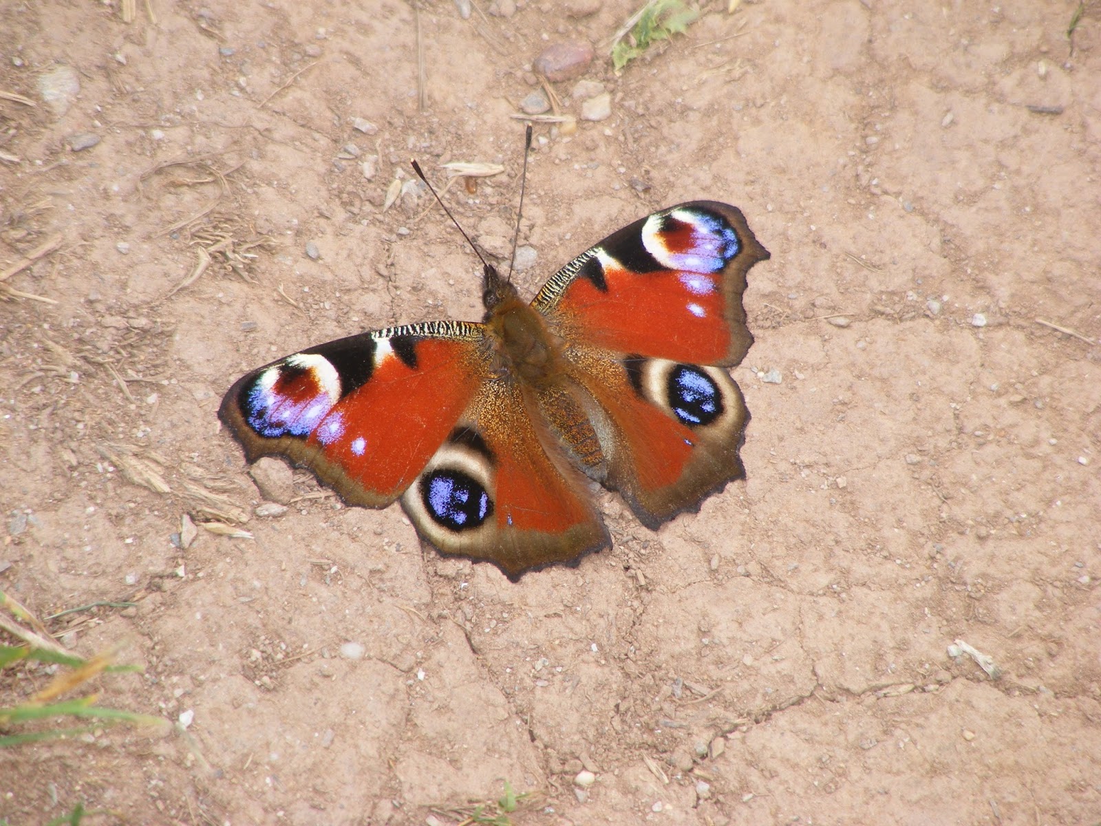
As we walked we were amazed at the number of butterflies we saw.  Many of them were landing on the path in front in front of us.


This moth was dead on the path


As we approached Great Mattiscombe Sands the path improved and the walk from there to Lannicombe beach was relatively easy and fairly flat with only gradual short climbs.  The beach at Great Mattiscombe looked lovely with fine sand.  Lannicombe was more stoney, though we could see that as the tide went out there was sand.  There were only a few parking spaces at Lannicombe at the end of a track so I am glad that we did not drive there.  We had planned to turn around at Lannicombe, which was fortunate as there has been a landslide just past there and the footpath has a long diversion.

Initially we planned to walk across the fields from Lannicombe to Hallsands, but the coastal path was so scenic and such a good path we decided just to retrace our steps to Great Mattiscombe Sands.  We then took the direct path back to the car park, which was uphill, but a good path.

After a rest we then walked from the car park down to Hallsands. Again we had fantastic views around Start Bay all the way and loads of white butterflies fluttering around the fern on the bank at the side of the path. It was very interesting to see the information of the lost village of Hallsands on the viewing platform overlooking the village.


As we walked back we had the view of the Lighthouse.  Unfortunately it was quite a climb back to the car park, not particularly steep but a long climb that was not good at the end of a day's walk.  It would have been better if we had parked at Hallsands, which was free, and walked from there, and then the last part of the walk would have been downhill.

Sunday 11 August 2013

Lerryn to St Winnow

We parked the car at the car park in Lerryn that overlooks the creek.  The stepping stones across the water were submerged so we walked past the houses and across the road bridge.  We walked up the hill then turned down a road on the left that led us back to the riverside.  From here we walked along the creek until it met the river Fowey.  With the tide going out there was a lot of mud but it was still a pleasant walk through woodland.  It was mainly flat with some undulation as we walked up away from the water and them down again.  At a couple  of points we had to go across stepping stones as there was an inlet of water but it was mainly a good path.

When we reached the River Fowey there was good views down the Fowey.  It was a pity it was a cloudy day and not high tide.

View down River Fowey to Golant

Fungi in the wood along the path
When we reached the River Fowey we continued walking along its bank until we came to St Winnow. At we approached this village there were a couple of steep stiles and then we had to walk around a corner on the beach at edge of the water until we came to the centre of the village.


Looking up the River Fowey from St Winnow

St Winnow
We decided that instead of retracing our steps we would walk across the fields on a more direct path back to Lerryn.  To begin with the path was clearly marked but we had to walk through fields full of cows and although the view back was good it was not spectacular.  There were a number of stiles that had to be climbed over.  Eventually we came to stile and some steps that led us down to a forestry road.  Our instinct told us to turn left, but as we walked along we realised this path was leading away from the river and Lerryn.  We read our guide book and realised we should have turned right then left, but rather than head back we continued on hoping that we would be able to get back on track.  After walking for half an hour we were on a road which we thought should lead us to Lerryn, but we could not see it and it did not look familiar, so we decided to turn back.   After we got back to the stile and steps it did not take us long to get back to the creekside and within half an hour we were back in Lerryn.  This time we crossed the creek by the stepping stones.

The walk along the creek and riverside was very pleasant, but I would not bother to try to walk back across the fields.  Even if we had not got lost there was not anything worthwhile to see.

Once home we studied a detailed map and realised if we had continued to walk along the road we would have come to Lerryn, but it was quite a busy and narrow road, so I am glad we turned back when we did.

Wednesday 7 August 2013

Peek Hill and Sharpitor

We had been told that there were marvelous views from the top of Peek Hill but never been there. Today as we wanted just a short walk we thought we would go and see for ourselves.

To reach Peek Hill you have to drive through Dousland and park at the side of the road.  We were able to get into a small area which holds only two or three cars.  The path up Peek Hill goes straight up from here.  If this is full you need to park at the car park at the foot of Sharpitor.  The view from where we stopped the car is spectacular, and we looked forward to seeing how much better it would get as we went higher up.

View across to the River Tamar

There was a clear grassy path leading up to Peek Hill which was marked by stones at the side.  To begin with you cannot see the top of the Hill, although Sharpitor was obvious to the left. After about 10 minutes gradual walk uphill you reach the ridge From there we walked across to the flat granite stones perched on the top of Peek Hill.   The view from the top was magnificent.  Only Sharpitor prevented you having a 360 degree vista  As well as the view we had from the car we could also see down to Burrator reservoir

Burrator Reservoir from Peek Hill
.
Brentor

There were lots of Dartmoor ponies grazing on the slopes and they had young foals with them.


We walked along the ridge to Sharpitor, which has a lot more granite scree on its slopes.  We scrambled across the stones to reach its summit and have a different view of Burrator.


We decided to walk down from Sharpitor to the car park at its foot, but this was not such a good path as the one we had come up.  It was not such a clearly defined path and there were lots of stones along the way and at times it was very wet with streams and pools to be avoided.  But again it was a very gently slope and we soon came to the pool next to the car park, where more ponies had gathered.


We then walked along parallel to road back to our car.

This had not been a long walk, taking less than an hour, but it was one of the most scenic walks I have done.  It was slightly misty on the afternoon we went and we could still see for miles, it must be even better on a completely clear day.  This is definitely a walk I would recommend to others and I will be doing it again I am sure.