Saturday, 28 July 2012

Slapton to Blackpool Sands

After a very hot week the temperature had dropped today so we were keen to do another section of the South West Coast Path.

We drove the car to Brixton then caught the 93 bus to Kingsbridge.  Although we could have stayed on the same bus all the way to Slapton, we chose to spend an hour in Kingsbridge and catch the next bus to our destination.  It was lovely riding on the top of the double decker with great views over the Devon countryside.

We got off the bus at the memorial at Slapton Sands and started to walk in an eastward direction.  We tried walking on the beach but the Sands were shingle and it was hard work walking on it.  The coastal path started being on the nature reserve side of the road.  There were lots of wild flowers and butterflies, but no view.  We were therefore pleased when the path crossed the road and went along the edge of the beach where there were far reaching views of  Start Bay.  There were wildflowers on this path as well.


At Strete Gate we left the beach and the main A379 behind and climbed steadily up an old road.  Unfortunately before long we hit the main road again and had to walk along this until we reached Strete (not good).  The other side of the village we walked across fields and soon had wonderful views around Start Bay.


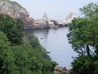
After walking on further we stopped for lunch with fantastic views along the coast to Blackpool Sands.


We then had to walk down and up the Landcombe valley.  Both sides of the valley were very steep and going down the hill was very precarious.  We then cross the main road again and had to head inland across fields  before coming down to Blackpool Sands.


We had read that they had a large screen at Blackpool Sands so planned to stop there for a while watching the Olympics while enjoying the beach and being by the sea.  However the screen was situated in the car park, near the toilets, and there were no seats, so we did not stay long watching it, but just stayed on the beach until the next bus came.


Thursday, 26 July 2012

Bedford Bridge to Grenofen and Gem Bridge

The weather continues to be scorching hot, not pleasant to walk in, but after so many weeks of wet weather we wanted to get out into the fresh air and enjoy the countryside.  We therefore chose a walk through woods where we would be sheltered from the sun.  We also started early in the morning so we could finish walking before the temperature rose too high at midday.

We parked the car at Bedford Bridge (Magpie Corner) and walked along  the river to Grenofen.  At times we were picking or way through tree roots, or over boulder in streams joining the main river or skirting muddy patches.  So although it was lovely to walk by the river it was not the easiest of walks in places.  Half way along the large legs of the new Gem Bridge came into view.  It is certainly a huge structure and feat of engineering, but with all the trees we did not get a good view of it.

We continued on to Grenofen Bridge where we stopped for a drink.  Although we had been in the shade nearly all the way we were  still feeling the heat.  Refreshed we headed up the hill towards Roborough.  This is the steep hill we came down last time and commented then that we would not like to climb!  We took the first pathway off and walked through woods.  This time the path was much better and before long we saw the Gem Bridge.


We had to walk on a bit further before we could get on the new cycle path, and we then walked across the bridge to see what the view was like from that.


The river was a long way down, but there were far reaching views towards Dartmoor.


We started to walk along the cycle route, but it was out in the open sun so we were glad when we saw a path through the woods.  We followed this path down to Bedford Bridge.

Sunday, 22 July 2012

Torquay to Babbacombe

Summer finally arrived on Saturday 21 July!  After over 6 weeks of wet and showery weather we finally saw clear blue skies so we could plan to spend a whole day walking.

We took the train to Torquay   (very crowded with others heading to the beaches).  With our ticket we purchased bus plus tickets so once we had arrived in Torquay we could use all the buses.  We took the bus from the railway station to the centre and then another bus to St Marys Church.  We walked down to Babbacombe Model Village then turned right and started walking back towards Torquay.

To begin with we walked along the top of the cliffs at the side of gardens and we could see all along the coast beyond  Exmouth.

Oddicombe Beach.  Recent heavy rain has cause a landslide
 Soon we came to the South West Coast Path and as usual there were plenty of ups and downs, but it was not too strenuous.  We kept near to the sea at all times, although we could not always see it because of the trees.  However, there were many good viewpoints to see the islands just off shore and rock formations.


We gradually worked our way down to see level at Meadford Beach and rewarded ourselves with a delicious icecream at the cafe there before we tackled the last hill up to Daddyhole Plain.  This is where we had got to last time we walked along the coast path from Torquay last year.  We knew it was only a short walk down to the town by road.  After stopping for a cup of tea in Debenhams looking out over the harbour we took the bus back to the train station.  It had been a lovely day and a lovely walk.

Sunday, 15 July 2012

Sibbleback Lake

There was a break  in the wet weather on Sunday, but we knew that paths would be very muddy so we chose to go to Sibbleback  as we had heard that the had up graded the path that wound around the Lake.

When we arrived, after the long narrow road from the main road to the Lake, we saw that people were wakeboarding on the zip line.  We were fortunate to get a space in the car park that allowed us to watch as we sat in our car.

We then set off to walk around the lake.  The path certainly was better than the last time we did this walk and it was a good path all the way round with very little mud.  There was not much activity on the lake, just one yacht, a fisherman and the wakeboarders.  There were foxgloves at the side of the lake which brightened some of the views.


The path stayed close to the lakeside, so this was a flat walk and very easy.  We were soon back at the start to enjoy a cup of tea in the cafe and watch the wakeboarders again.

Tuesday, 3 July 2012

Yealm Estuary from Wembury

After another wet week we were expecting showers on Sunday afternoon and paths to be muddy, so we did not anticipate having a proper walk so I did not take my camera when we went to Wembury Beach.  However, it was fine so we started to walk and it turned into a lovely walk.  And surprisingly the paths were not muddy.
We were following the walk on the nationaltrust.org.uk site.  We walked from the end of the car park along the South West Coast Path up to Rocket Cottage where the SW Coast Path goes down to the ferry across the Yealm.  Instead of taking this path we walked on into Clitters Wood.  We had glimpses of the River Yealm with the moored yachts through the trees.  The path went up to nearly Thorn House, which was the garden I visisted earlier in the year.  At this point we cut inland and went across fields until we came to Warrens Lane.  The walk on the national trust site went right at this point to go into Wembury village.  However, we turned left and walked down the lane to Rocket Cottage and then walked back to the car along the SW Coastal Path.

There were a number of ups and downs on this walk but it was not too strenuous and we will definitely have to redo it when I have my camera.

Wednesday, 27 June 2012

Wacker Quay to Antony

The weather had been dreadful recently, not what you would expect in June.  It seemed to rain most days so we realised most paths would be muddy.  Sunday was not a particularly good day but at least it was dry so we took the opportunity to have a short walk.

I had read that the pathway between Wacker Quay and Antony had recently been worked on by volunteers so we decided to take a look at this path.  Beforehand we called into Antony House and had a walk around the gardens.  They were not looking as good as I remember them from last year.  There were however an impressive row of trees with white flowers.


We walked down to the Woodland Garden but the path was sodden and we had to squelch along.  We did do the short walk around these Gardens but on the way back walked up the road to the car park rather than back along the muddy path to Antony House.

The car park to Wacker Quay was well signposted from the main road, but it was a very narrow single track road to the car park, and a car was coming out as I was going in so I had to reverse!  We started walking along the marked path from the Quay towards Antony, but it was very muddy.  Before long we turned back, but we had heard people walking below us along the side of the river so we found the way down to this 'beach' and walked along there instead.  There was a dry edge quite a long way along, only once having to pick our way through seaweed.  Eventually, though we came to marshland, but there were steps there that lead up to the path we had been on previously.  We then continued along this path hoping to reach Antony.  There were wild irises and other summer wild flowers out along the path and views of the River Lyner.  Unfortunately it was low tide so it was muddy.


Eventually, when we must have been very close to Antony, the path became so muddy we had to turn back, but it had been a pleasant walk, but not spectacular.

Monday, 4 June 2012

East Soar to Overbecks

Today was a Bank Holiday and an ideal day for walking - cloudy, warm, and not windy.  We drove to the National Trust car park just past East Soar village and walked down to the coastal path.  To begin with we started to walk towards Soar Mill Cove as this was as far as we walked when we were parked at Bolberry Down.  It was further than we thought and when the path started to go downhill we turned around.

Looking towards Soar Mill Cove

We then started to do the walk along the SW Coastal Path we intended that we had downloaded from http://www.nationaltrust.org.uk/servlet/pdf/1/478925/Trail/Walking/Bolt_Head_walk.pdf.

To begin with the path was quite flat although there was a steep path up and down at Starehole Cove.   The walk was made even prettier by the foxgloves along the way.
 There were lots of paths around the area.  We kept to the SouthWest Coast Path although did not go right out to the end of Bolt Head. At this point we may have missed the path we were meant to be walking along, but we continued in the right direction, but maybe a little inland.

As we got nearer the end of the walk we had lovely views up the River to Salcombe


Before long we reached the National Trust property, Overbecks.  We should have walked past the outside of it and had to walk back to the entrance on the other side, but we came down the path by the side of the entrance, so we must have gone wrong somewhere!  The gardens were looking lovely with lots of unusual plants.


On the walk back to the car we had to walk through Tor Woods.  Leaving Overbecks we saw a signpost for this so we followed this path.  But in fact it did not lead us through the woods but at the side.  This meant we cut out a portion of the walk so we will have to redo this another time.  But it made the walk back to the car even quicker and it was a good flat path all the way from the edge of the woods.